Here’s David Epstein’s forecast for the ‘intense’ storm ahead
Flooding of rivers and streams will again be a concern with these next rounds of heavy precipitation — the first major weather event of April.

In a month that featured significantly more rain than average, Easter weekend turned out dry and comfortably mild. Hold on to that memory as we only have one more nice day of weather — Monday — before things go downhill. I’m confident it will become quite stormy in the coming days, especially during the middle and end of the work week.
This far in advance of a significant storm system, a lot of the details still need to be ironed out. In early April, precipitation type is still an issue, and there is the possibility that we will end up with parts of New England seeing a major snow event. And even where snow doesn’t fall, there’s going to be quite a bit of rain.
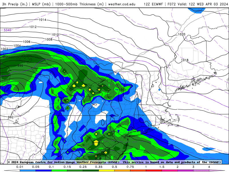
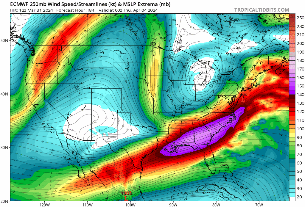
A storm will traverse the middle part of the country early this week before heading up into the Great Lakes. This primary storm will then spawn a secondary, more dominant storm along the New England coast that could become quite intense Wednesday into Thursday.
Flooding concerns
This storm will bring renewed chances of flooding, with likely more minor and moderate flooding of multiple rivers and streams later this week as 1 to 2 more inches of precipitation fall across the region. Coastal flooding will be minor as tides are astronomically low this week, but there could still be beach erosion from larger waves.
One question with this upcoming storm is what kind of precipitation will we actually see? During this time of the year, higher elevations are the most likely to experience wintry weather. And although it certainly is possible to get a big snowstorm in April, even at the coastline, snow in Boston is highly unusual this late in the season. Also, without a lot of cold air present this week, it would be tough to see a snow event along the coast.
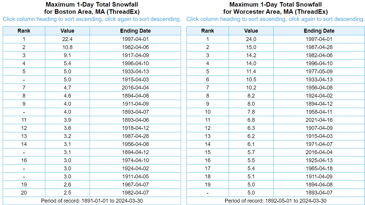
The Top 20 one-day April snow totals for Boston and Worcester are below, and as you would expect, Worcester has received higher totals this late in the season.
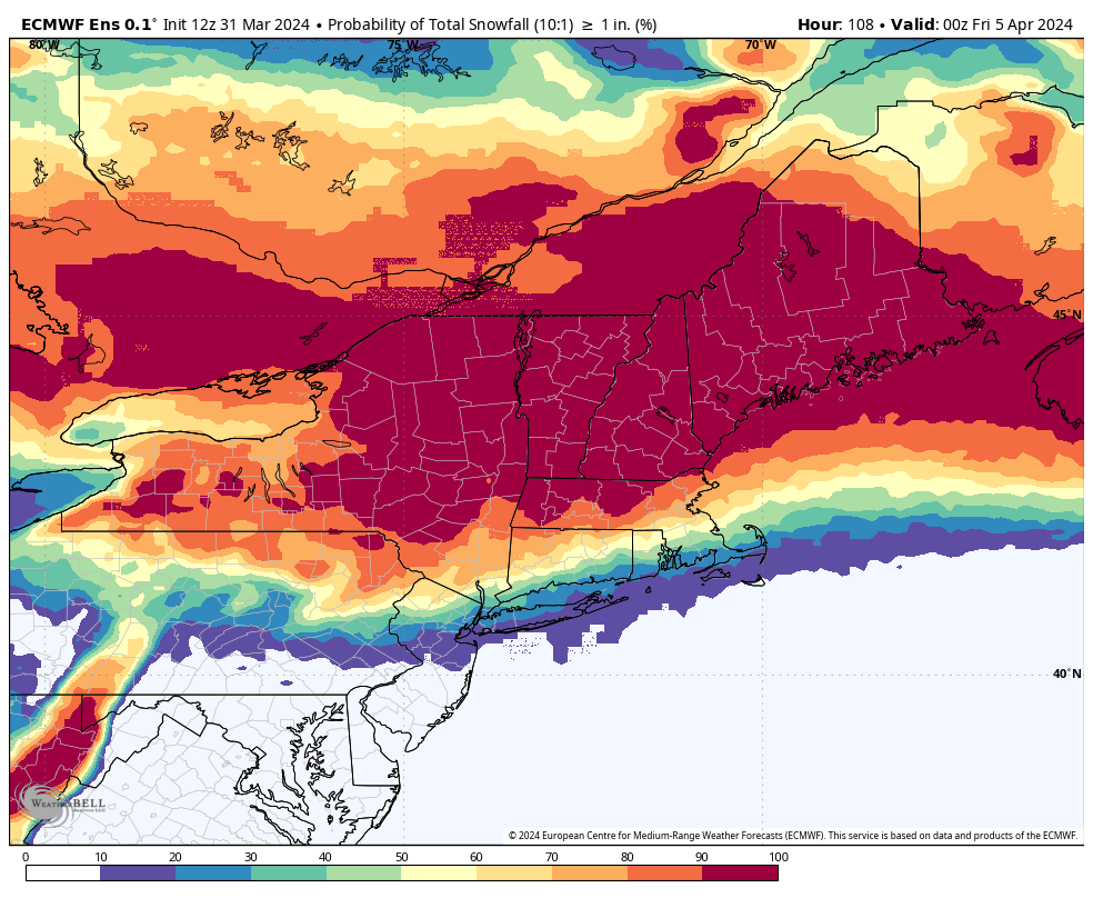
Right now, the probability of the upcoming storm bringing at least an inch of snow is actually quite high from roughly Route 128 west to north. This doesn’t mean it will happen or is a forecast yet. Remember, these numbers will fluctuate a lot leading up to the storm. The probability of snow quickly decreases to the south, getting closer to the warmer Atlantic.
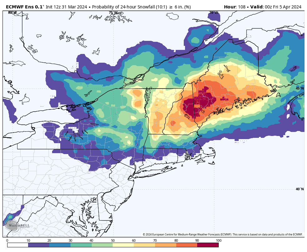
When I raise the threshold to 6 inches or greater, the probability rapidly decreases and remains high only across Northern New England and especially the higher elevations of Maine and New Hampshire. That would be the most likely spot to get hit with a more powerful storm. The snow will be heavy and wet, and power outages would be likely.
Gusty winds
If you’re wondering about wind during this storm, it will begin to become breezy later Wednesday peaking during Thursday and then subsiding Friday. For those of you over inland areas, you can expect winds at their peak to be between 30 and 40 miles an hour while the coast will experience winds between 40 and 50 miles an hour. There’s likely to be at least wind advisories issued later this week.
Whatever happens, the storm will tend to wind down on Friday, but because of the upper-level winds capturing the storm, it will be slow to depart.
The good news is that it could take until Sunday before it finally clears the area, hopefully leaving us with good weather for Monday, April 8, when the total solar eclipse takes place in the afternoon for the Northeast.


Conversation
This discussion has ended. Please join elsewhere on Boston.com