Here’s Dave Epstein’s storm forecast
Expect two rounds of snow and rain over the next 24 hours.

There have not been many changes in the forecast since Saturday — we still are going to receive quite a bit of precipitation over the next 24 hours. Much of it is expected to be in the form of rain in the lower and coastal elevations but also in the form of snow, especially in the higher elevations.
It is impossible to tell everyone the exact time it will be raining and snowing at your house, but generally it’s mostly snow above 1,000 feet in elevation. Elsewhere it will be a mix, trending to all snow during the early morning hours of Monday.

The temperature before 6 a.m. was between about 35 and 37 degrees in much of eastern Massachusetts. If it did snow at these temperatures, it would be very tough to accumulate.
There are two thrusts of precipitation during this storm that will affect the area. The first will be Sunday morning. This is when a heavy slug of the precipitation in the form of snow is likely to occur over the higher elevations.
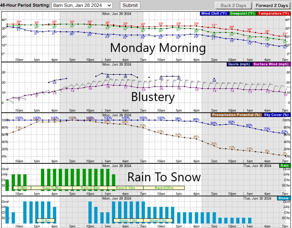
The meteogram below gives an idea of our upcoming weather around Greater Boston. These are not exact, but you notice the green bars representing rain being replaced by blue representing snow for Monday. The rain-snow line should collapse to the coast in the early morning hours Monday. Even in Boston, a wet snow, although not accumulating much, is likely during the commute Monday morning.
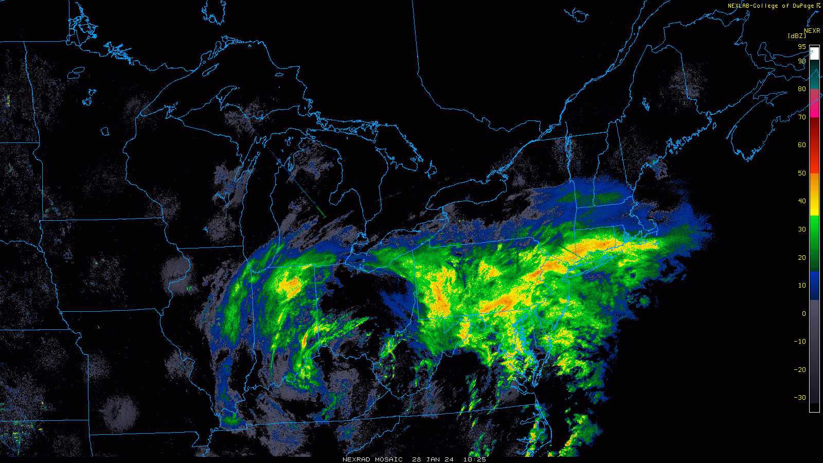
A wide radar loop from this morning indicates low pressure back over Ohio and West Virginia. You can actually see the counterclockwise circulation associated with that storm. We also have more rain and snow extending to the right of that moving across the Northeast. The precipitation won’t end until that low pressure system gets far enough east of us, and it’s going to take a while.
As the first round of moisture passes later this afternoon, there may be either a lull or a complete cessation of the precipitation for a little while before it fills back in overnight.
The air will be slightly colder Sunday night, especially after 2 a.m. when the mixed precipitation should start to trend more toward snow. At the ground, readings will be within a few degrees of the freezing mark, and therefore the snow will be heavy and wet when it does accumulate.
There’s an outside chance of a few scattered power outages over the higher elevations where snowfall will be greatest. Elevation will matter a great deal in the system so you could literally be driving through the same town and at the higher points have an inch or two more than at the lower elevations.
The snow will wind down Monday afternoon along with a bit of a gusty northerly wind. Temperatures will fall back to the teens Monday night so any slush will freeze pretty solid.
On Tuesday we only reach the 20s in spite of sunshine, but it’s back above freezing by the middle of the week.


Conversation
This discussion has ended. Please join elsewhere on Boston.com