Newsletter Signup
Stay up to date on all the latest news from Boston.com
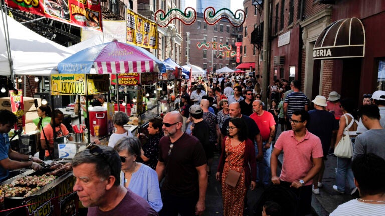
Oliver Wendell Holmes may have been writing satirically when he called Boston the “hub of the solar system,” but the name stuck.
After all, Holmes had a point: World-class medical facilities, universities, championship sports teams, and a healthy dose of Dunkin’ all contribute to the city’s gravitational pull.
But how far does that pull extend? Where should you draw the line for Greater Boston?
We set out to find the answer — or rather, answers. As it turns out, there’s little consensus on which cities and towns can consider themselves part of Greater Boston.
“There’s always different ways to understand what a region is, and really the answer is: ‘Well, what’s the question you’re trying to answer?’” said Tim Reardon, director of data services at the Metropolitan Area Planning Council.
“The housing market extends deep into the state and up into New Hampshire, but if we’re talking about … what’s the area influenced by all the cultural amenities in Boston, maybe it’s a little smaller,” he said. “There’s no one definition of Greater Boston that I would necessarily default to.”
For MAPC, which is focused on Boston’s metropolitan area, the map includes 101 cities and towns stretching from Duxbury to Ipswich and branching west to Marlborough.
The Greater Boston Association of Realtors cuts their map a bit smaller, notably excluding Quincy and Braintree. Meanwhile, the Greater Boston team at MassDevelopment, the state’s development finance agency, reaches down into Hingham but only operates as far west as Framingham.
If you’ve harbored fantasies of annexing other parts of New England, you may appreciate the Boston–Cambridge–Newton metropolitan statistical area (MSA) offered by the U.S. Office of Management and Budget, which boldly cuts into New Hampshire.
Boston is “one of the cities that has the most complicated histories of defining what its urban geography consisted of,” said historical geographer Garrett Dash Nelson, president and head curator at the Boston Public Library’s Norman B. Leventhal Map & Education Center.
He did a study in 2016 that used commuting data from throughout the U.S. to create regional boundaries based on commuting patterns. The data essentially put all of eastern and northern New England into a single urban region with Boston — not dissimilar, Nelson said, to what a map of Red Sox Nation might look like.
The Boston Foundation research center Boston Indicators typically focuses its work on Essex, Middlesex, Norfolk, Suffolk, and Plymouth counties — all part of the MSA but contained within Massachusetts, explained research analyst Peter Ciurczak.
“It really does come back to that question of, ‘OK, what are you trying to find out, and what is the best boundary to use in those particular circumstances?’” he said.
Comparing Boston’s metropolitan area with other cities? The broader MSA definition could come in handy. Studying public transit? The map of the 175 MBTA communities — which stretches out past Worcester — might be more applicable.
Speaking of Worcester, how does the so-called Heart of the Commonwealth feel about being lumped in with Greater Boston?
According to City Manager Eric D. Batista, Worcester has its own metropolitan area with a rapidly growing footprint.
“The physical and perceived divide between Worcester and Boston is blurred, begging the question, where does one begin and the other end,” Batista said in a statement.
There’s more to Greater Boston’s regional identity than a certain accent or a devotion to Market Basket, Nelson, over at the map center, said.
“But I do think that underlying a lot of this are the sort of material connections of how we live our lives,” he said. “Almost nobody lives, goes to school, goes to work, shops, gets their entertainment all within the boundaries of one municipality, or certainly one neighborhood.”
Having so many different definitions of Greater Boston can make headaches for those in the business of data aggregation, Reardon said.
Sometimes, “it would be more convenient if we were in another region where there was a very clear county boundary definition and we could go with that,” he said. “But you know, that’s what makes our region special.”
Wickedpedia: Your unserious questions, seriously answered. Have a question about Greater Boston or New England you’ve always wondered about but never thought to ask? Boston.com’s new Wickedpedia series aims to track down the answers to these long-burning (often random) reader questions — the more obscure the better. Submit your question below or email it to [email protected], and if it’s selected, we’ll put a reporter on the case.
Sorry. This form is no longer available.
Stay up to date on all the latest news from Boston.com


Conversation
This discussion has ended. Please join elsewhere on Boston.com